Bowen Harbour Drone and Ground Photography for Arup
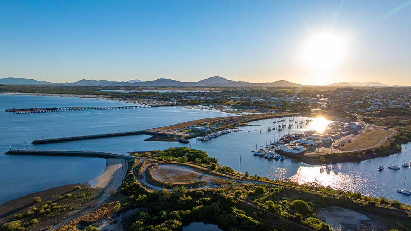
Understanding a harbour means seeing how its parts connect. For Arup’s work on the Bowen Harbour Master Plan, TDM captured ground and aerial imagery to document existing conditions and give the project team a range of visual perspectives on the site.
Our Bowen Harbour documentation project covered 14 priority points, with photography and video showing features including creek crossings, breakwaters, moorings and the yacht club area. The brief centred on useful site documentation for designers, planners and stakeholder discussions.
From eye level to the wider harbour
The capture plan combined eye-level views with aerial imagery at 30, 70 and 120 metres. Those different viewpoints help communicate both local details and the wider relationships between land, water, access and maritime facilities.
A ground photograph can show a feature as someone encounters it on site. A higher view can place that same feature within the harbour. Capturing both gives a project team more choice when explaining a location to people who may not have visited it themselves.
Planning for light, tides and movement
Our production schedule considered morning, afternoon and sunset conditions alongside the tides. For a coastal site, changing water levels and light can influence which features are visible and how clearly they read in a photograph or moving shot.
The video coverage included reveal shots, orbits and tracking movements. These give the viewer a sense of how the site’s features sit together, while photographs provide individual views that can be selected for documents and presentations.
Delivering material for the client’s own team
The photographic deliverables received minor retouching, while the video footage was supplied raw and unedited for Arup’s internal team. That delivery reflects the purpose of the brief: supplying visual material that the client could incorporate into its own planning and communication work.
Our role was to capture the site clearly. Decisions about the master plan sit with the planning team and responsible agencies; the imagery gives them another way to examine and communicate the existing environment.
A visual record within a broader planning process
The Queensland Department of Transport and Main Roads’ Bowen State Boat Harbour project information describes the broader work toward a long-term vision for the harbour. Our contribution sits within that setting as photography and video of the place being considered.
For infrastructure and coastal projects, a clear capture brief helps turn a large site into an organised set of usable views. Identifying the priority locations, required angles and final delivery format before the shoot makes the material easier to put to work.
See more imagery and the scope on the Arup Bowen Harbour project page. If your team needs visual site documentation in Bowen, the Whitsundays or surrounding regional Queensland, contact TDM about our drone photography and videography and ground photography services.