Three Sites, One Island: TDM Takes Drone Inspection to Dent Island
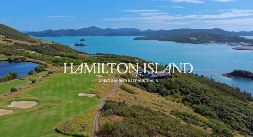
Three proposed sites, multiple elevations and a coastline that changes with every viewpoint: TDM’s aerial inspection on Dent Island brought a proposed wellness-centre brief into focus.
Captured in September 2025, the project used drone videography to show the outlook from three potential development locations near Hamilton Island. Our role was to provide visual material for early planning, helping the client compare what each site could offer.
Three proposed sites, captured for comparison
On our Dent Island wellness-centre inspection project, the brief defined viewpoints and heights before filming. We captured each proposed site from those perspectives, then brought the footage together into a consolidated planning video.
That approach gives a design team more useful information than a scenic flyover alone. Changing the camera’s elevation changes what sits in the foreground, how the surrounding landscape is revealed and which views remain visible from a potential building position.
By filming at multiple heights, we could show the scale of the terrain and the visual corridors across the island and surrounding water. The material was prepared to support architectural visualisation, renders and development discussions.
Aerial visualisation before a building exists
For an island development, the outlook is part of the design brief. A view from ground level can be very different from the view at a proposed upper floor or elevated terrace.
Our pre-planned capture connected the proposed viewpoints with real footage of the landscape. It gave stakeholders a visual comparison of the options, while leaving the architectural and planning decisions with the client’s specialist team.
Dent Island sits beside Hamilton Island in the Whitsundays. The island’s official property information describes its existing golf-course setting and broader development potential. Our commission focused specifically on the proposed wellness-centre sites.
Working near Hamilton Island Airport
The aerial work took place within controlled commercial airspace near Hamilton Island Airport. Flight planning required coordination with aviation stakeholders and adherence to the operational approvals for the job.
That coordination formed part of delivering the requested viewpoints. A useful planning video depends on reaching the right positions safely and consistently, with the capture brief and the operating environment considered together.
Drone inspection with a clear planning purpose
The final video combined the three locations into one reference for stakeholder review. TDM delivered the aerial capture and site visualisation; the work documented a proposal during planning and does not establish that the wellness centre has since been approved or built.
For architects, developers and property teams, our drone inspection and aerial filming services can be planned around the views, elevations and site features they need to understand. The starting point is the intended use of the footage, followed by the capture positions and final presentation.
Watch the site comparison on the full Dent Island project page, or talk to TDM about aerial visualisation for your next development.